Mount Logan: The Titan of Canada1 and a Window to its Physical Geography
Syllabus: UPSC GS-I (Physical Geography)
1. Introduction – Identity of a Giant
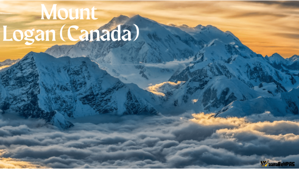
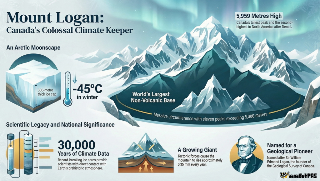
Mount Logan, rising to 5,959 metres, is the highest peak of Canada and the second highest in North America after Mount Denali. It is located in the Saint Elias Mountains of Yukon Territory within the Kluane National Park and Reserve, a UNESCO World Heritage Site. More than just a tall peak, Logan is regarded as the largest non-volcanic mountain on Earth due to its enormous base and multiple summits, making it a true “titan” of the North.
Fact File
- Territory: Yukon, Canada
- Mountain System: Saint Elias Range (North American Cordillera)
- National Park: Kluane National Park & Reserve
- Elevation: 5,959 m (19,551 ft)
For UPSC geography, Mount Logan is significant for understanding tectonics, glaciation, climate, drainage and Canada’s northern environment.
2. The Logic of the “Largest” – The Logan Massif
Unlike typical single-cone mountains, Mount Logan is a vast massif—a block of crust containing many peaks.
- The Logan massif has 11 peaks above 5,000 m.
- Dimensions: nearly 20 km long and 5 km wide.
- The summit plateau is so extensive that it could accommodate Mont Blanc, Eiger and Kilimanjaro together.
This exceptional horizontal spread gives Logan the largest circumference of any non-volcanic mountain, an important conceptual point for physical geography students.
3. Geological Significance – A Living Mountain
Mount Logan is part of the North American Cordilleran System, created by the interaction of the Pacific Plate and North American Plate.
- Formed through tectonic uplift and terrane accretion
- Intensely modified by glacial erosion
- Currently rising at about 0.35 mm per year, making it a “living mountain”
Its official height was confirmed only in 1992 by the Geological Survey of Canada using GPS, highlighting advances in modern geomatics.
UPSC Link:
Demonstrates plate tectonics, young fold mountains, and active geomorphology of western North America.
4. Climate and Cryosphere – From Green Valleys to Arctic Moonscape
Mount Logan shows dramatic vertical climatic zonation:
- Base temperature in summer: up to 20°C
- Plateau temperature: median –27°C, winter lows –45°C
- Ice cap thickness: nearly 300 m
Orographic lift from the Pacific Ocean causes heavy snowfall, feeding massive glaciers like:
- Hubbard Glacier
- Logan Glacier
- Seward and Columbus Glaciers
This makes the region one of the world’s largest non-polar ice fields, crucial for studying climate change and cryospheric processes.
5. Drainage and Environmental Importance
Mount Logan acts as a major water tower of north-western Canada:
- Glacial melt feeds the Yukon River system
- Western slopes drain toward the Gulf of Alaska
- Supports ecosystems, indigenous livelihoods and hydro-potential
Canada Keypoints (UPSC Focus)
- Western Canada dominated by the Cordilleran mountain belt
- Northern Canada characterized by sub-arctic and polar climate
- Sparse population, emphasis on conservation and national parks
- Economy linked to forestry, minerals, hydropower and tourism
6. Human Discovery and Exploration
- 1890: First sighted by geologist Israel C. Russell
- Named after Sir William Edmond Logan, founder of the Geological Survey of Canada
- 1925: First successful ascent by Albert H. MacCarthy’s team after a 65-day expedition
Even today, access requires glacier flights from Haines Junction, and climbing is strictly regulated to protect this fragile environment.
7. Analytical Importance for UPSC
Mount Logan helps explain:
- Active Pacific–North American plate boundary
- Dominance of glacial landforms in Canada
- Contrast between Pacific coastal climate and continental interior
- Role of mountains in drainage and resource geography
Conclusion
Mount Logan is not merely Canada’s highest peak; it is a natural laboratory illustrating the nation’s tectonic evolution, glacial dominance, climatic extremity and environmental stewardship. Understanding this mountain enables a deeper grasp of the physical and human geography of Canada, a theme frequently tested in UPSC Prelims and Mains.
Question Reference
- Question Reference
(HPAS PYQ 2025), Q. No. 21 ↩︎