Mont Blanc: Tectonic Grandeur, Glacial Architecture and the Geography of France1
Syllabus: UPSC GS-I (Physical Geography)
1. Introduction – The Roof of Western Europe
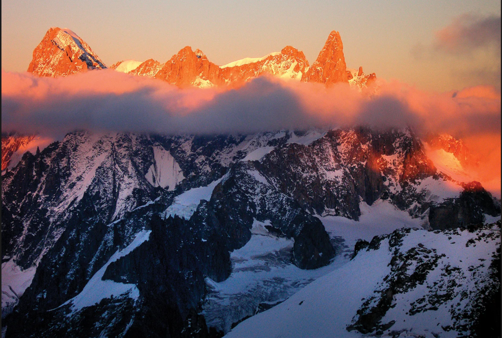
Mont Blanc (≈ 4,805–4,810 m) is the highest peak of the Alps and Western Europe, located on the France–Italy border within the Mont Blanc Massif. More than a summit, it is a meeting point of tectonic forces, glacial processes and human imagination. The massif forms a natural barrier between Chamonix (France) and Courmayeur (Italy), historically creating distinct cultural landscapes. For UPSC geography, Mount Blanc is a classic example of:
- young fold mountains of the Alpine orogeny,
- glacial geomorphology,
- trans-boundary drainage and resource systems,
- interaction of relief, climate and settlement in Europe.
Geographic Profile of the Massif
- Contains 11 peaks above 4,000 m
- Tripoint near Mont Dolent – France, Italy, Switzerland
- Watershed divide between the Rhône basin (France) and Po basin (Italy)
- Marks a climatic split: moist northern Alps vs drier southern Alps
- Vertical ecological zoning from forests (<2000 m) to permanent ice (>2700 m)
2. Geological Evolution – The Making of a Giant
Alpine Orogeny
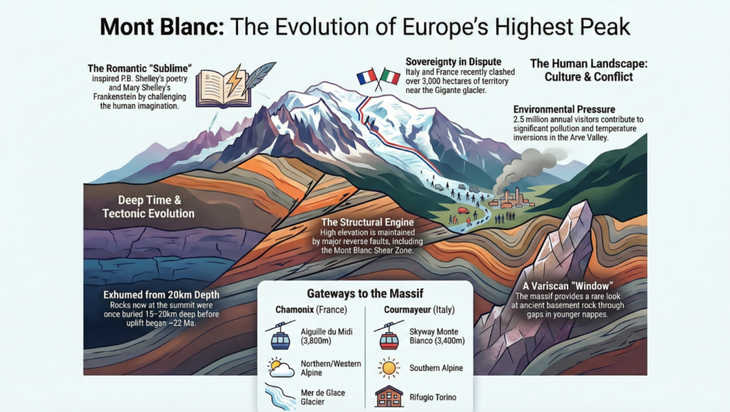
Mount Blanc owes its origin to the collision of the African and Eurasian plates (64–2.5 million years). The massif exposes an exhumed Variscan basement of:
- Protogine granite (≈304–316 Ma)
- gneisses and metamorphic rocks
- intensely folded sedimentary cover
Phases of Tectonic Development
- Formation of Penninic nappes
- Burial beneath 6–12 km of thrust sheets
- Regional doming and uplift
- Development of the Mont Blanc shear zone (4 km wide)
- Recent brittle deformation along the Mont Blanc back thrust
This created the dramatic 3,500 m vertical drop into Val Veni and the steep southern face that defines the mountain’s modern silhouette.
UPSC Concept Link:
Illustrates plate convergence, nappe structures, basement exhumation and active mountain building.
3. Glaciation – The Architect of the Present Landscape
The Quaternary Ice Ages sculpted Mount Blanc into a textbook alpine landscape:
- Mer de Glace – largest glacier of France
- Bossons, Taconnaz glaciers
- classic landforms:
- cirques, arêtes, horns, U-shaped valleys
- moraines and hanging valleys
Glaciers continue to retreat, making the massif a global observatory for climate change and cryospheric studies.
4. Climate and Drainage Importance
- Alpine climate: heavy snowfall, low temperatures, strong winds
- Major hydrological divide:
- North-west → Rhône system → Mediterranean
- South-east → Po system → Adriatic
These waters support:
- hydropower in France and Italy
- irrigation of Rhône valley
- tourism economy of Chamonix–Courmayeur corridor
5. France through the Lens of Mount Blanc (UPSC Keypoints)
- Alps form France’s south-eastern physiographic unit
- Control France’s climatic diversity:
- oceanic west → continental interior → Mediterranean south
- Alpine rivers: Rhône, Isère, Durance – backbone of HEP and agriculture
- Strategic connectivity: Mont Blanc Tunnel linking France–Italy
- Economy: ski tourism, dairy pastoralism, alpine transport hubs
- Environmental focus: protected alpine ecosystems, glacier monitoring
6. Human Landscape and Strategic Dimension
- Chamonix evolved as a centre of modern mountaineering
- Courmayeur preserved traditional Italian alpine culture
- Trans-boundary management between France–Italy–Switzerland
- Contemporary issues:
- glacier retreat,
- tourism pressure,
- minor border disputes—insignificant compared to geological time.
7. Scientific Significance – The “So What?”
Mount Blanc provides:
- a rare vertical section from deep crust to surface lavas,
- global model for caldera and shear-zone studies,
- laboratory for climate–glacier interaction,
- understanding of how relief shapes European culture and economy.
Conclusion
Mount Blanc is a fusion of tectonic power and glacial artistry. It explains the geography of France and the Alps—how plate collisions built the mountains, ice carved the valleys, rivers shaped economies, and humans adapted around them. For UPSC, it stands as an ideal case to connect geomorphology, climate, drainage, resources and regional geography of Europe.
- Question Reference
(HPAS PYQ 2025), Q. No. 21 ↩︎