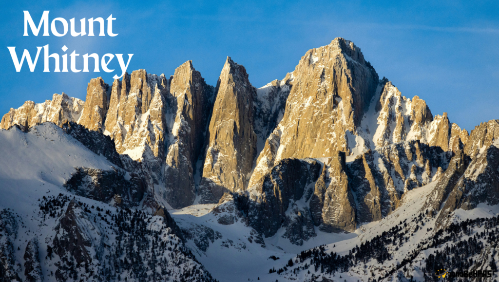
Mount Whitney
1. Map Location & Geospatial Identity
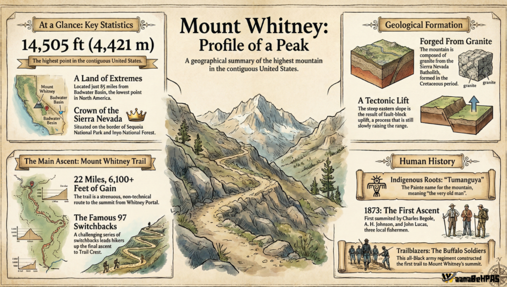
Mount Whitney is the highest peak of the contiguous United States (14,505 ft / 4,421 m). It is located in eastern California, along the eastern edge of the Sierra Nevada Range, close to the Nevada border.
Atlas Positioning (UPSC Map Work):
- Continent: North America
- Country: USA
- State: California
- Counties: Inyo & Tulare
- Mountain System: Cordilleran System → Sierra Nevada
- Coordinates: 36°34′43″N, 118°17′31″W
Mount Whitney occupies a critical transition zone between two major physiographic provinces:
| West | East |
|---|---|
| High Sierra Nevada (uplifted granitic block) | Basin & Range Province (stretched, faulted desert) |
This makes it the topographic anchor of western USA.
2. High–Low Relief: A Global Geographical Phenomenon
Mount Whitney lies just 84.6 miles from Badwater Basin in Death Valley (–86 m), the lowest point in North America.
This creates:
- The greatest vertical relief in the contiguous USA
- Drop from +4,421 m to –86 m in a short horizontal distance
UPSC significance:
This reflects the intense tectonic stretching of the Basin and Range Province adjacent to the uplifted Sierra Nevada fault block.
3. Geological Structure & Tectonic Origin
Mount Whitney is part of the Sierra Nevada Batholith, a huge mass of granitic rock formed from magma solidification during the Cretaceous period.
Geological Evolution:
- Subduction of Pacific Plate beneath North America → magma intrusions
- Formation of granitic plutons (87–83 million years old)
- Tectonic uplift & faulting
- Glacial erosion exposed the granite core
The Sierra Nevada Frontal Fault tilted the range westward, causing the eastern face (Whitney side) to rise sharply over Owens Valley.
The same granite at Whitney’s summit is found in the Alabama Hills, thousands of feet lower—showing massive vertical displacement.
4. Hydrological Importance: The Great Basin–Pacific Divide
Mount Whitney is the apex of the Great Basin Divide, meaning it controls two major drainage systems of western USA.
| Western Slope | Eastern Slope |
|---|---|
| Kern River → California → Pacific | Owens River → Owens Lake → Great Basin |
| Supports agriculture & cities | Endorheic desert drainage |
Human modification:
- Western water used for California’s Central Valley agriculture
- Eastern water diverted to Los Angeles Aqueduct
Thus, Mount Whitney influences:
- Urban water supply
- Agricultural productivity
- Desertification of Owens Valley
5. Climate & Alpine Ecology
Mount Whitney has an Alpine Tundra (ET) climate.
- Long snowy winters
- Short, cold summers
- Thin air & high UV radiation
Ecological adaptations:
- Sky Pilot – cushion plant retaining heat
- Gray-crowned rosy finch – extreme-altitude bird
- High-altitude butterflies
This is typical of high Cordilleran mountain climates of North America.
6. Cultural & Indigenous Geography
To the Paiute Mono people, Mount Whitney is called Tumanguya, meaning
“The Very Old Man”, home of the Great Spirit.
The modern name Mount Whitney was imposed during 19th-century US geological surveys, reflecting the colonial mapping of Indigenous landscapes.
7. Conservation & National Importance
Mount Whitney lies within:
- Sequoia National Park
- Inyo National Forest
The Buffalo Soldiers (1890s–1900s) were among the first to:
- Build trails
- Enforce conservation
- Protect the Sierra Nevada ecosystem
The Smithsonian Shelter (1909) near the summit was used for early astronomical research.
Infographic
8. Why Mount Whitney is UPSC-Relevant
Mount Whitney helps explain:
| Concept | Linked Feature |
|---|---|
| Tectonic uplift | Sierra Nevada Fault Block |
| Drainage divide | Pacific vs Great Basin |
| Climate contrast | California wet vs Nevada dry |
| Relief extremes | Whitney–Death Valley |
| Human geography | LA Aqueduct & agriculture |
| Cordilleran system | Backbone of western North America |
Conclusion
Mount Whitney is not merely the highest peak of the contiguous USA; it is a tectonic, hydrological, climatic and cultural pivot of the American West. It controls water flow, relief, climate, ecosystems and settlement patterns, making it one of the most geographically significant landforms of North America — and a highly valuable case study for UPSC physical and regional geography.